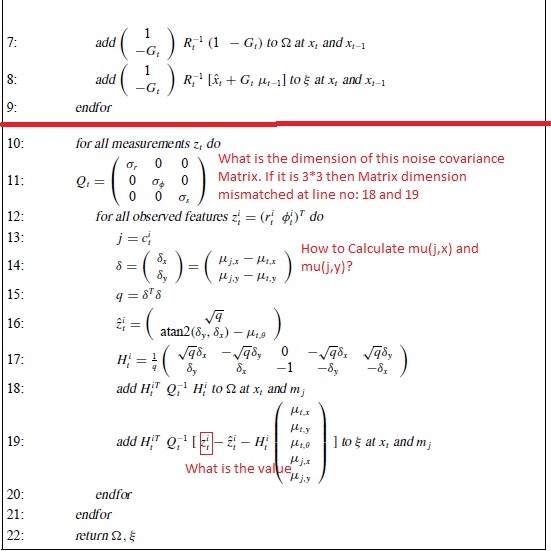
I try to implement GraphSLAM from this tutorial, The GraphSLAM Algorithm with Applications to Large-Scale Mapping of Urban Structures. I have some doubt while studying this paper. I hope people who research on same field may solve my query.
As I don't know how to input notation in StackExchange editor I have uploaded a picture with my queries:
I have some questions, which are written in the images, at line numbers 11, 14, 19:
- What is the dimension of this noise covariance matrix? If it is 3*3 then the dimension of the matrix is mismatched at line numbers 18 and 19
- How to calculate $µ(j,x)$ and $µ(j,y)$?
- What is the value of $z_t^i$?
I have some other doubts:
- What is the need to use two
forloop one line number 10 and another one at line number 12? - Is that use to change the value of $Q(t)$ in each iteration? How can all measurements and observed features be different from each other?
I am using this dataset, UTIAS Multi-Robot Cooperative Localization and Mapping Dataset, where there is a sensor measurement data set and odometry measurement dataset. They are two separate files. Their timestamp is also different. Their dataset is like that after 100 odometer data there is a data which observed a features. Then how could I relate these datasets with this algorithm?
