The problem with defining the terms SLAM, and odometry is that various people define them differently, and sometimes even use them interchangeably. It can also change depending on what your main sensor is(camera vs LIDAR), and even what sort of feature representation you use (scan-matching vs landmark based).
So for this question I am going to use the terms odometry/SLAM in regards to a LIDAR sensor with a scan matching implementation.
if I only use a single lidar without any other sensors like IMU and no
loop closure in the mapping process, is this jsut a laser odometry?
You are mostly right about this. SLAM is just odometry with loop closure. However, you can use multiple sensors(IMU,GPS,...) and still have it be odometry. Sensor fusion doesn't define whether it is odometry or SLAM.
Can I get a map?
Yes. Since you know your poses from odometry you can still combine the LIDAR scans into a map. However, since you don't have loop closure you can't refine the map which is the key part of SLAM(SLA-MAPPING).
Another question is what's the relationship between loop closure
detection and backend optimization in laser SLAM? Does there exist
backend optimization without other sensors and loop closure detection?
When we are doing backend optimization we are essentially taking the history of past poses and trying to optimize them all together. However, this is useless without knowing any additional information. It would just give us the same result as running the odometry algorithm. So somehow you need to introduce additional information/constraints.
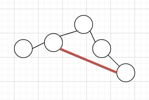
This is where loop closure comes in. If we know these two poses distant in time are actually connected. Then we have introduced new information.
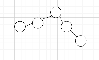
Here is the pose graph of just odometry, and with a red loop closure link.


You can see with the loop closure we are adding new information(the extra edge).
Using a pose graph is a good way to visualize problem, because if you can think of any new ways of adding edges and nodes to this graph then you are introducing new information.
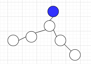
Some other options are a localization constraint. We know a pose is connected to some landmark/map with known position.
 .
.
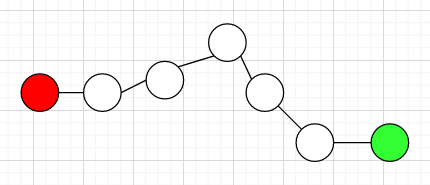
Another popular one is that we know the start and end location of the robot/car. So we fix those and optimize the positions of the rest.
 .
.


