4
$\begingroup$

I am trying to create a feature grid map with

  1. Images from camera mounted to the top of the car.
  2. Novatel ProPak RTK gps poses

Beforehand, I've checked to ensure that the standard deviations of the latitude/longitude (>5cm) and heading (<0.5 degrees). The steps are I tried are as follows

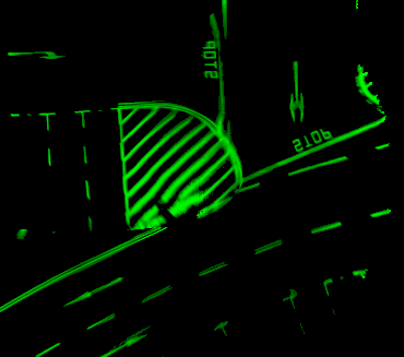
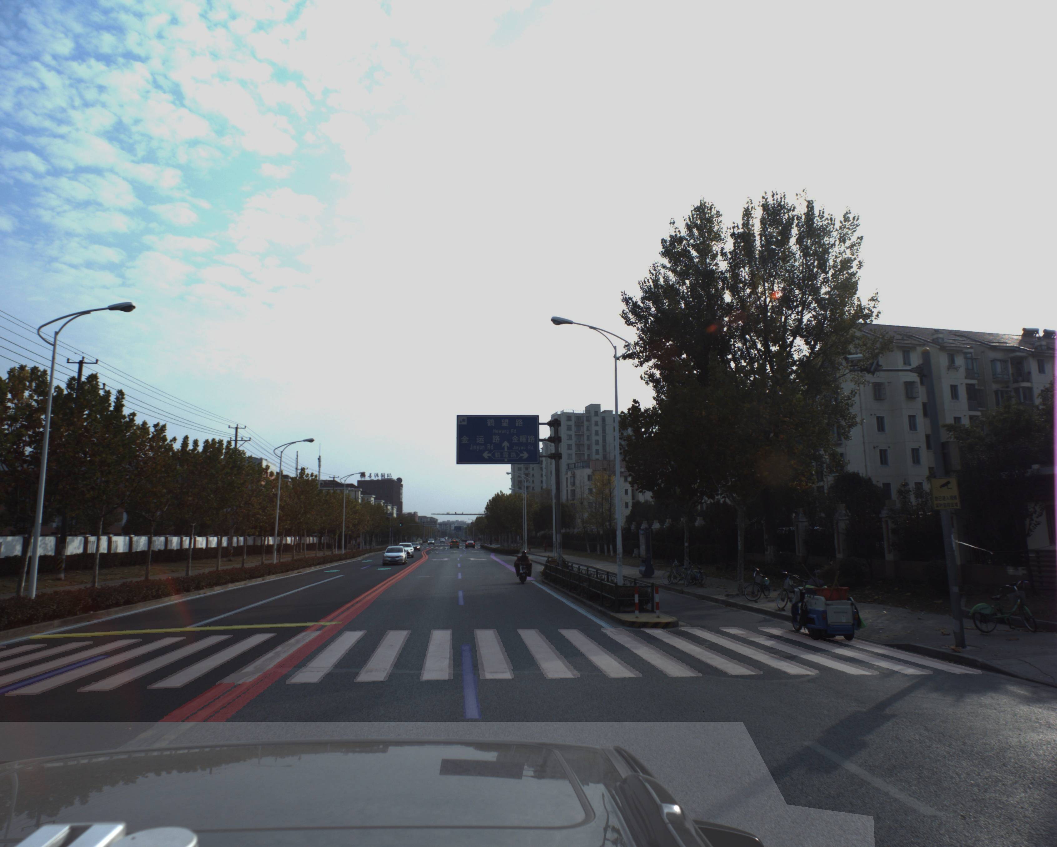
  • I use CNN based semantic segmentation to extract out pixels which are part of road markers (see sample below).
  • I use the first gps pose as my origin map frame.
  • Next, I use the calculated height of camera to calculate a homography between the image plane and the ground plane.

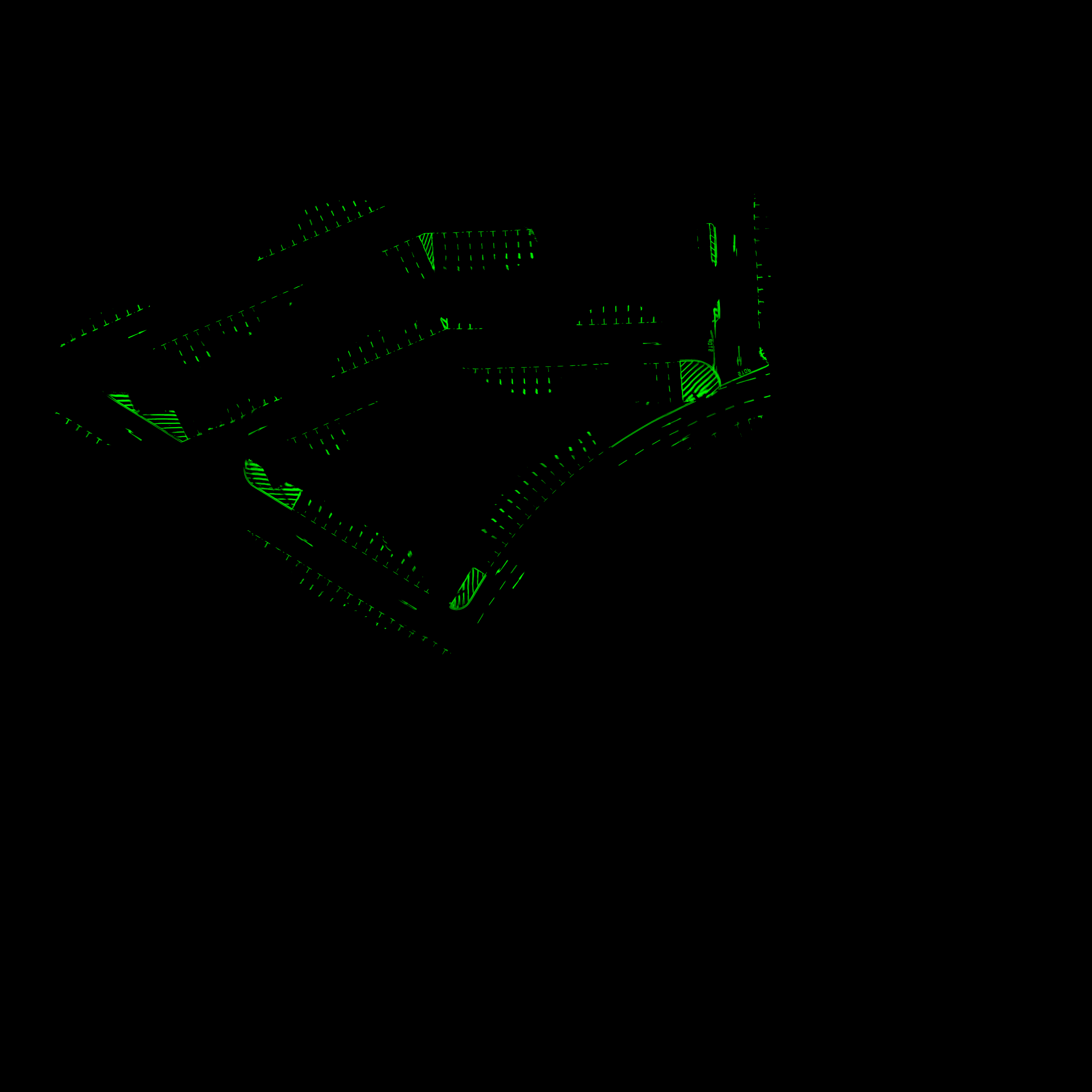
  • Finally, I just accumulate the points into cells as the vehicle drives around. The second image below shows the map of an outdoor carpark I created.

    Question: I noticed some parts of my map have significant ghosting or are incorrect. See 3rd image below, the stop line is not straight at all. I have notice that thishappens when the vehicle is turning, as is suspicious of 2 reasons:

  • I do not know if this is due to the transformation between the camera and the gps being inaccurate,

  • or that the transformation between camera and ground being inaccurate.

    I seek advice on what I should do next to verify what is the problem, or what should I do to fix these issues.
enter image description here

enter image description here

enter image description here

$\endgroup$

1 Answer 1

1
$\begingroup$

I came to this question from your other question, but I think the answer is better suited here.

It looks like your GPS only provides position and no heading information, so that would explain why you're noticing more trouble during vehicle turns.

I don't know if you're filtering your GPS data before use, but the GPS datasheet advertises "sub-meter accuracy," and again there's no heading information. I would suggest using a digital compass to get heading information and to use a filter to smooth your GPS signal.

An IMU could be paired with the GPS for even better positioning accuracy, which I think is probably ultimately what your problem boils down to - your transform chain (on the other question) doesn't have any step at which it adjusts rotation.

If you're looking for a way to validate, then try to setup a scenario where you can recreate and eliminate the bug - try to induce ghosting where you haven't seen it (make a U-turn in the middle of a street where you were getting good data) and try to eliminate ghosting where you have seen it (go straight through the stop intersection instead of turning.) If you're able to reliably recreate and stop the problem, then correct it by adding a rotation measurement (compass/IMU).

$\endgroup$

Your Answer

By clicking “Post Your Answer”, you agree to our terms of service and acknowledge you have read our privacy policy.

Not the answer you're looking for? Browse other questions tagged or ask your own question.